One-day road trip across Garhwal’s Doon, Dhanaulti and Tehri.
It’s 9 o’clock on a November morning, but I’m surprised to see that Doon’s winter is still bearable this late in the year. After having breakfast and tea, we headed out for our first stop at Dhanaulti. At Ballupur Chowk, we took the route that goes via Garhi Cantonment, which eventually merges with the Mussoorie Road at Malsi. This route circumvents Doon’s busy Clock Tower and Rajpur Road.
A view of the Doon Valley from a restaurant along the Mussoorie Road.
We continued along the Mussoorie Road until we reached JP Bend, a sharp turn that appears some distance before the multi-level car park at Kincraig. I’ve always been curious about the origins of Kincraig, a place that is difficult to locate on Google Maps and relatively unknown to anyone except the locals. According to some text I found, the name - no marks for guessing it was given by the British - was inspired by a place in Scotland. Prior to 1950, Kincraig was the last point accessible by vehicles, beyond which people had to travel on foot.
At JP Bend, we took the road that diverges towards Landour, which eventually leads us to Dhanaulti.
A picturesque view from Burans Khand with a backdrop of white-topped mountains, quite possibly Yamunotri.
As a child, I had been to Eco Park, a popular attraction in Dhanaulti. However, upon our arrival, it seemed as though I had no recollection of it. I vaguely remembered an apple orchard being present somewhere in the vicinity of the park. My dad informed me that the orchard was a private estate, although open for visits, situated at the upper heights of the mountain where the park was located. If his memory served him right, there was a path to the orchard that began from inside the park and an another less trodden one that lay outside and away from it.
Deodar trees are a usual sight across Dhanaulti.
Beyond the Eco Park, there are several restaurants that serve refreshments. We stopped at one before leaving for Chamba, which is the entry point to Tehri.
Surkhanda Devi Temple is located on the way. The stairs to the temple begin around an entrance arch right next to the road and lead to the top of the mountain where the temple is located. It is a nice little hike to the top and had been on my bucket list for a while. Since we were short on time, we couldn’t check it off that day. However, my mother felt that it would be appropriate for us to at least pay our respects at the entrance arch. Quickly getting out of our car, we went straight for the bell tied to the entrance arch, rang it, brought our palms together in a namaste, bowed our heads, and chanted ‘Jai Surkhanda Devi’.
En route to Tehri, we passed through Kanatal and Chamba. Chamba, in particular, seemed like a lively bustling town.
We finally reached Tehri Jheel (lake) at 2 in the afternoon. We seemed to have arrived at an opportune moment as there was an Acro Festival being held there. It featured boat riding, parasailing, jet skiing, and even paragliding from the top of the mountains. I was a little disappointed to learn that paragliding was not open to tourists but was strictly for experienced pilots who had apparently been invited from different countries by the organizers to take part in the Acro Paragliding competition.
Overall, it was nice to see the government promoting tourism, especially to the outside world.
Boating at the Tehri lake.
What we call the Tehri lake is a reservoir formed at the Sangam (confluence) of two rivers: the Bhagirathi River, flowing in from the northwest, and a much smaller Bhilangana River, flowing in from the east. At the confluence lies the Tehri Dam, which is powered by the reservoir. The river that comes out on the other end of the dam is still the Bhagirathi River, which eventually meets the Alaknanda River at Devprayag to form the mighty Ganga.
Photograph captured from a boat in Bhagirathi looking toward the hill that adjoins the Tehri Dam (bottom-right of the hill).
It was 4 o’clock in the evening and we thought it would be better to leave early to avoid driving at night, as much as possible by then.
For our way back, which would still go via Chamba, we took the Rishikesh-Chamba-Tehri Road that goes via Narendra Nagar and opens up at Rishikesh.
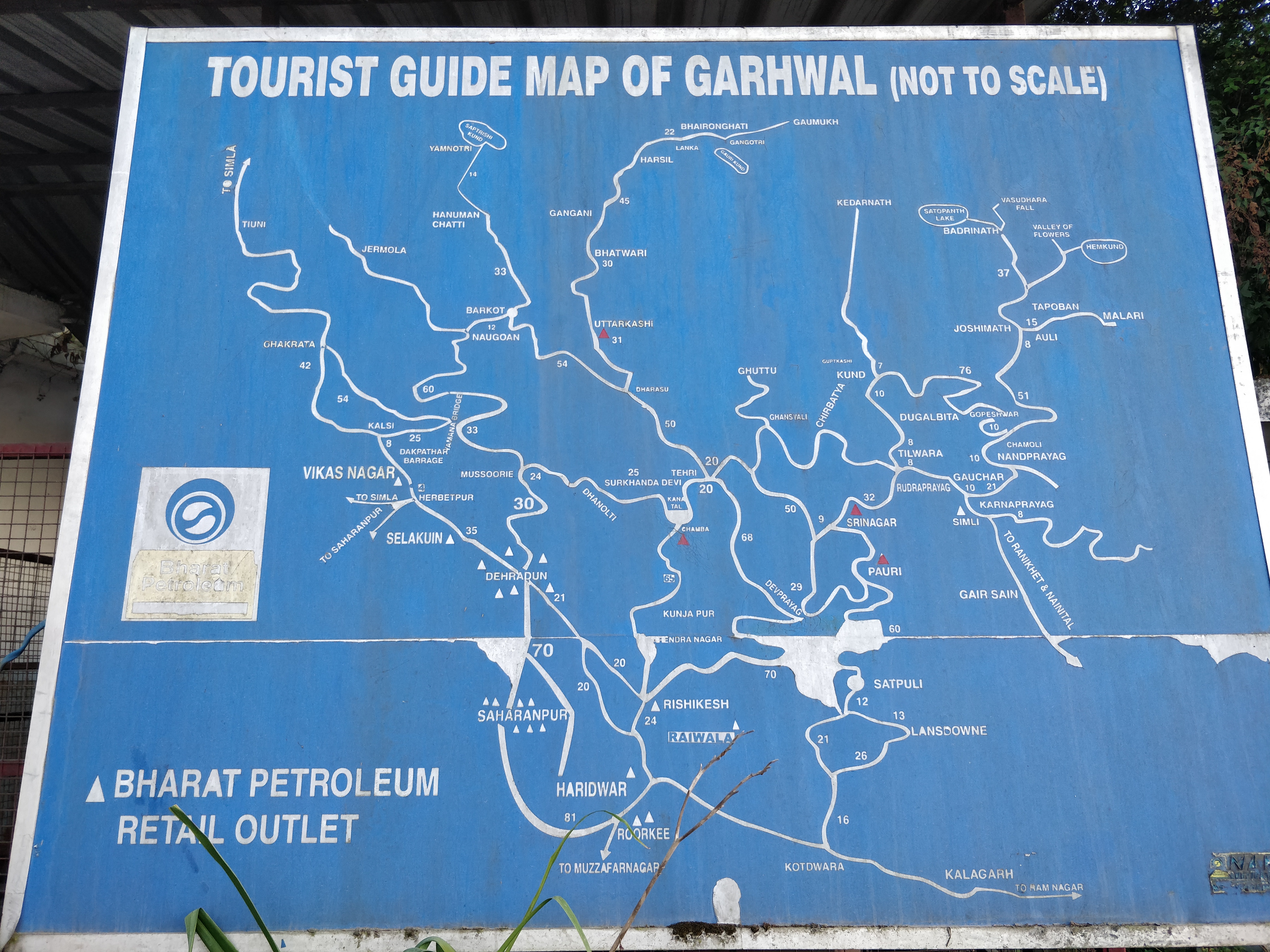
A map with Tehri in the middle.
A few kilometers behind Narendra Nagar lies a town named Agrakhal. Khal is a Garhwali word that refers to a hill with a flat top (closest english word: plateau). Many shops there were selling local produce, the most prominent of which was Adrak (ginger).
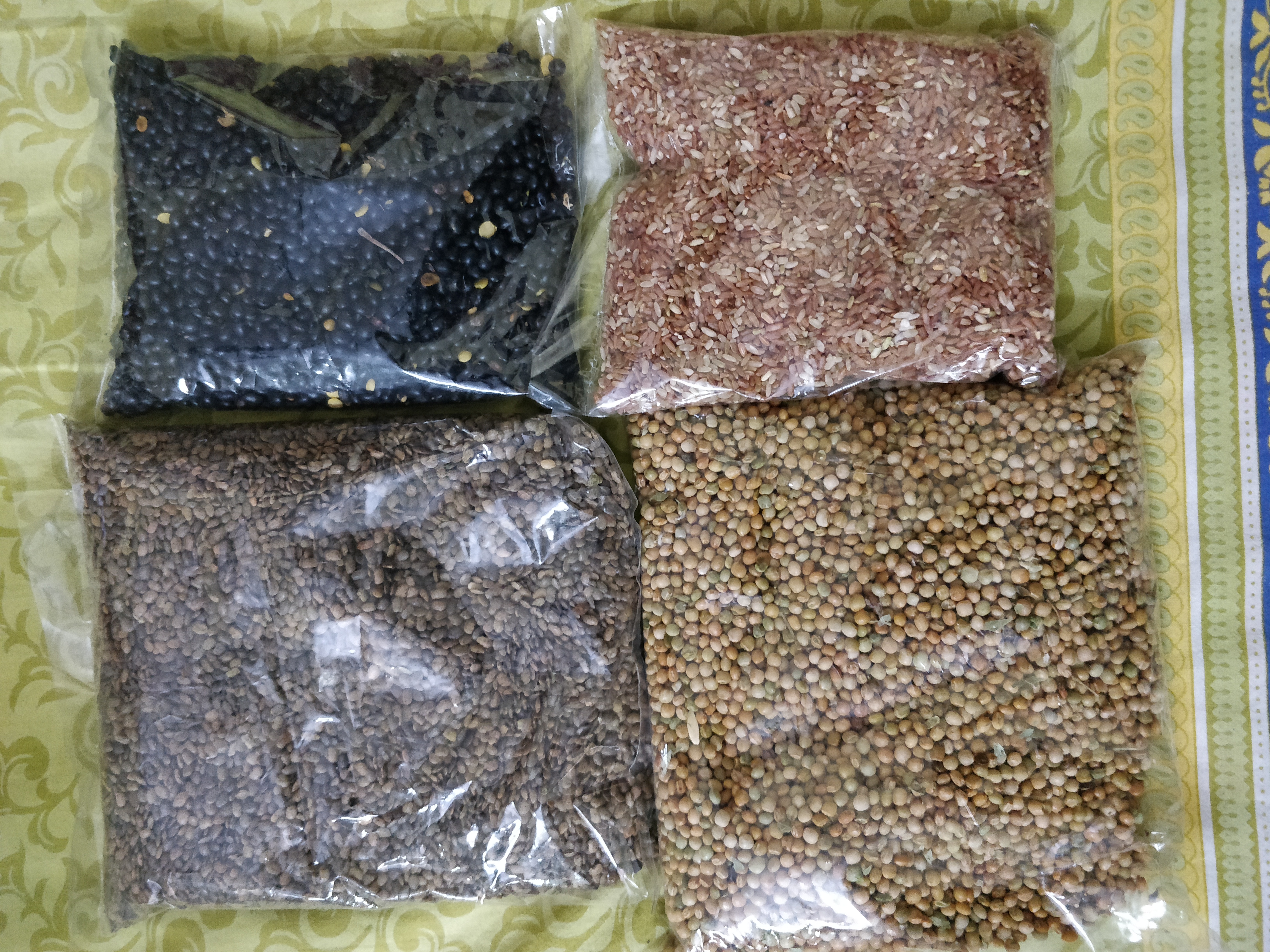
Some produce bought from Agrakhal:
(black) Bhatt Dal - makes for great Chutney
(red) Unrefined Rice - still contains bran which is used in making oil
(brown) Gaunth Dal - makes for great Parathas
(yellow) Sabut Toor Dal
Small restaurants serving tea and food had their kitchens facing outward toward the road. Something caught my eye: almost all of these had a pan of what is called Bhutwa - a stew of pieces of goat meat that had been cut from various parts of the goat. We ordered one plate, and while eating, I was only able to make out the pieces that tasted like liver. The rest of the bits and pieces tasted unusual to my tongue, which wasn’t privy to the various goat organs. Nevertheless, I finished the plate, thanked the owner Mr. Rawat, and we went on our way.
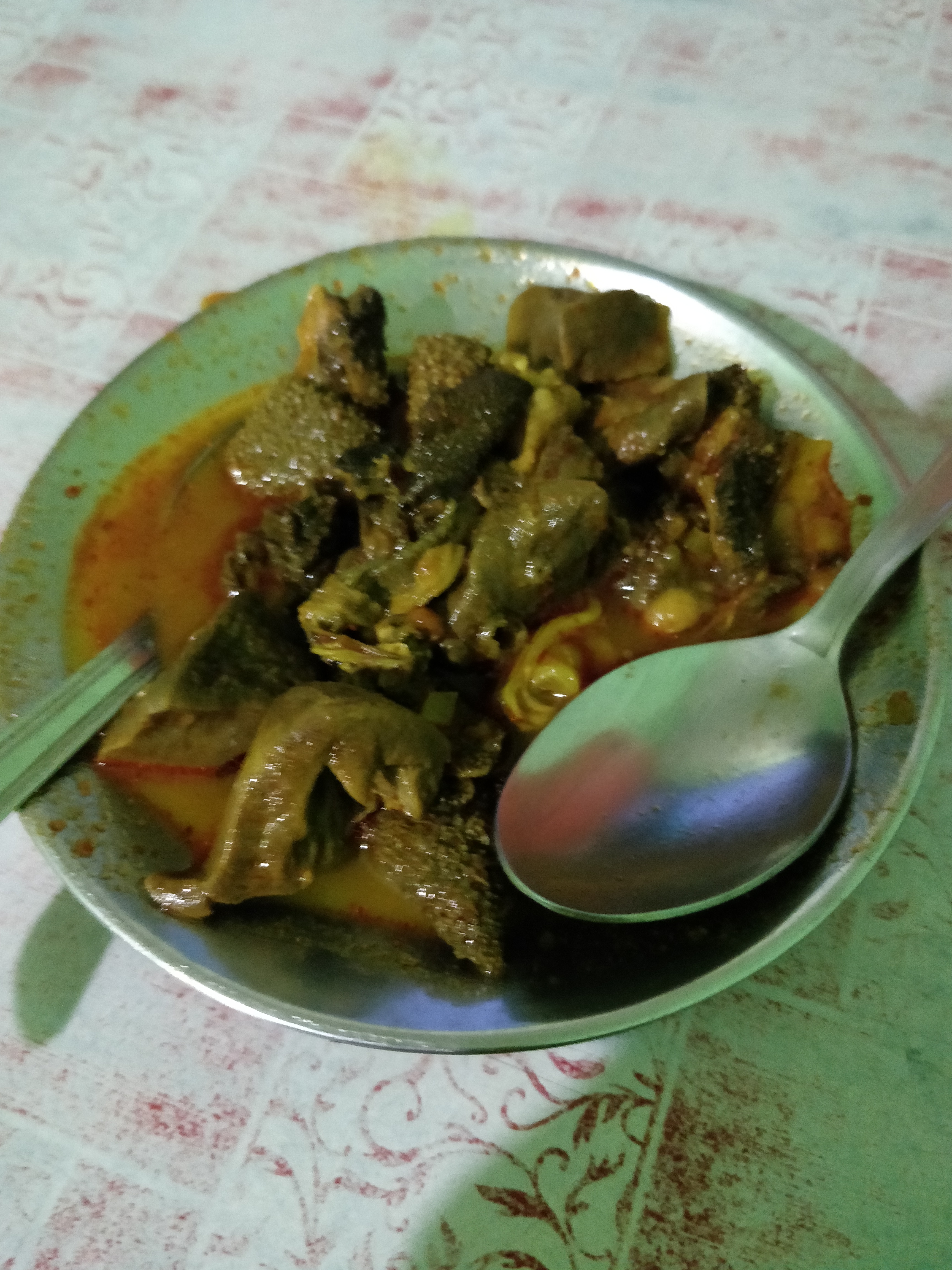
Bhutwa.
Narendra Nagar has been on my bucket list of places to visit on account of the Palace of Garhwal Maharajas that is present in the town. Narendra Shah, after whom the town is named, reigned over the Tehri Garhwal Kingdom from 1913 to 1946. In 1919, he moved the capital of the Garhwal Kingdom from Tehri to the place which would become Narendra Nagar. I was slightly disappointed to hear that a resort named Ananda had taken the Palace’s place. To me, historical structures such as this Palace must be preserved so future generations can cling to their past. I hope the resort has preserved the original Palace structures and also put on display its history for visitors to appreciate. I shall visit it someday.
Dusk taking over the Agar village as seen from Agrakhal.
At Narendra Nagar, we abandoned the Rishikesh-Chamba-Tehri Road for a Dehradun bypass road that seemed to have been laid down quite recently. We reached home by 8 at night, thanks to Dad’s experience in driving on hilly roads.